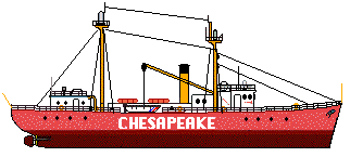
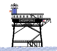
 Chesapeake Lightship
Lightships
Updated 1/23/2000
For years, the entrances to major waterways in the United States were protected by moored lightships. The first such lightship was used to mark Craney Island, VA ( Portsmouth, VA) in 1820. The names of the waterways often were painted on their sides. If a lightship was moved to mark a different waterway, the name would be changed and painted on it's side. Ligthships would anchor for extended periods of time to mark the waterway entrance and would be replaced by a temporary ship known as "Relief" when the regular lightship needed to be serviced.
|
The Chesapeake Lightship marked the entrance of the Chesapeake Bay until it was replaced by the present Chesapeake Light, a Texas tower type of platform. |
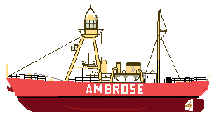
Ambrose Lightship |
Ambrose lightship was launched in 1950 and served to mark the the area near Cape Cod, Mass. She sometimes served as the relief ship for the Nantucket, Boston, Portland Light areas. .She is currently serving as a museum in Wareham, Mass. |
Light Towers
In the 1960's the Coast Guard began to replace some lightships with offshore "Texas" Towers. These towers were originially manned but over the years have become automated. The towers have living quarters and a rooftop helo pad for airlifting workcrews and or suppliesto the tower.
|
Chesapeake Light is located approximatley 15 N.M. east of the entrance to the Chesapeake Bay. Automated in the late 1970's, it stands as a lonely sentinel for Hampton Roads and a Mecca for small boaters wanting to fish offshore. |
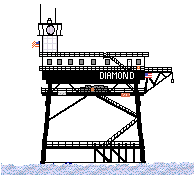
Diamond Shoals Light
|
Diamond Shoals Light is located approximatley 9 N.M. southeast of Cape Hatteras, N.C. Automated in the late 1970's, it marks the famous Graveyard of the Atlantic. |
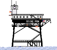
Frying Pan Shoals Light
|
Frying Pan Shoals Light is located approximatley 28 N.M. southeast of Cape Fear, N.C. Automated in the late 1970's, it marks the entrance to the Cape Fear River that flows into Wilmington, N.C. |
 Chesapeake Light